A GNSS (Global Navigation Satellite System) monitoring station, also known as a GNSS reference station, is a permanent ground-based observation facility that continuously tracks signals from satellite navigation systems such as BeiDou, GPS, GLONASS, and GALILEO. It acquires observation data by consistently receiving satellite signals and transmits this data to a data center in real-time or at scheduled intervals, forming critical infrastructure for satellite navigation applications.
01 In-Depth Understanding of GNSS Monitoring Stations
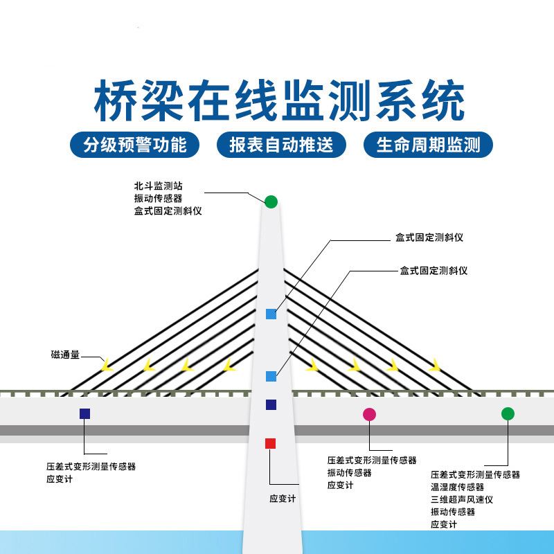
The function of a GNSS monitoring station is to continuously track satellite signals, providing data support for satellite orbit determination, atmospheric retrieval, and surface displacement monitoring. Particularly in high-precision positioning applications, a reference station can provide effective differential correction data to user terminals, enabling positioning accuracy at the centimeter or even millimeter level.
A reference station can be divided, based on its components, into an observation pillar, a receiver (including antenna), and communication facilities. Based on the type of observation pillar, they can be further categorized as bedrock stations, soil stations, rooftop stations, and steel tower stations. In practical applications, multiple reference stations are often networked together to reduce the number of sites requiring construction and to improve service availability.
02 Technical Principle
The fundamental principle of GNSS technology is to determine the receiver's position and time through trilateration. The system requires signals from at least four satellites to solve for four variables: latitude, longitude, altitude, and time. The signals transmitted by satellites consist of three basic components: navigation data, a Pseudorandom Noise (PRN) code, and a radio frequency carrier wave.
GNSS positioning accuracy is affected by various error sources, including the satellite's own clock and orbit errors, ionospheric and tropospheric delays during signal propagation through the atmosphere, and receiver errors. These errors result in standalone GNSS accuracy ranging from about 5 meters for entry-level devices to 1 meter for high-end devices.
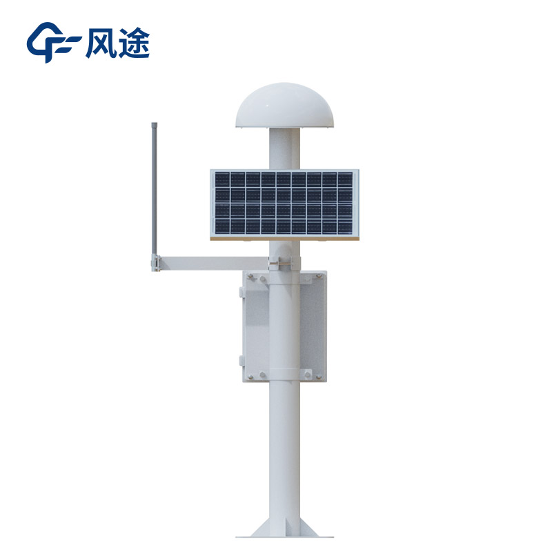
03 Fengtu GNSS Monitoring Station
The Fengtu GNSS Displacement Monitoring Station (Model FT-WY2) is a reference station device specifically designed for high-precision displacement monitoring.
It possesses the following technical characteristics in both hardware and software:
Supports the four major satellite navigation systems - BeiDou, GPS, GLONASS, and GALILEO - receiving signals across 11 frequency bands. It utilizes multi-system, multi-frequency fusion technology to achieve high-precision positioning.
Offers high static positioning accuracy: horizontal accuracy reaches ±(2.5 + 0.5×10⁻⁶ × D) mm, and vertical accuracy is ±(5.0 + 0.5×10⁻⁶ × D) mm.
Based on chip-level independent development, it features low overall power consumption, with a rated power of less than 1.2W, making it suitable for continuous field operation.
Embeds front-end algorithms such as sidereal filtering and Kalman filtering, and integrates cloud-based models for big data cleaning and trend analysis, ensuring data reliability.
Utilizes a milled aluminum alloy housing with internal and external sealing protection, offering excellent protection, shock resistance, and vibration damping. Its operating temperature range is -40°C to 85°C.
The device also employs a choke ring antenna technology, which effectively reduces multipath effects and enhances monitoring accuracy and stability. It can be widely used in engineering fields such as dam safety monitoring, bridge health detection, and landslide early warning, providing crucial technical support for infrastructure safety.
This paper addresses:https://fengtusz.com/industry/879.html