Flooding is one of the most common and widely distributed natural disasters worldwide. It is usually caused by extreme rainfall, torrential rains, snowmelt and river surges, which cause significant damage and loss of life in human societies and ecosystems.
Although flooding is prevalent globally, the forms of flooding and the factors affecting it vary from region to region.
For coastal areas, flooding is often triggered by hurricanes, tropical storms and heavy rainfall. These extreme weather conditions can lead to the backing up of the sea, inundation of coastal cities, and severe disasters such as storm surges.
Inland, on the other hand, flooding can be caused by flash floods, overflowing rivers, and standing water on the surface. These disasters can lead to serious consequences such as soaked farmland, collapsed houses, and waterlogged cities.
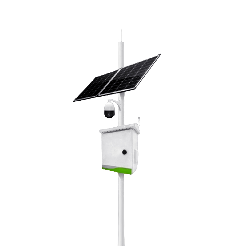
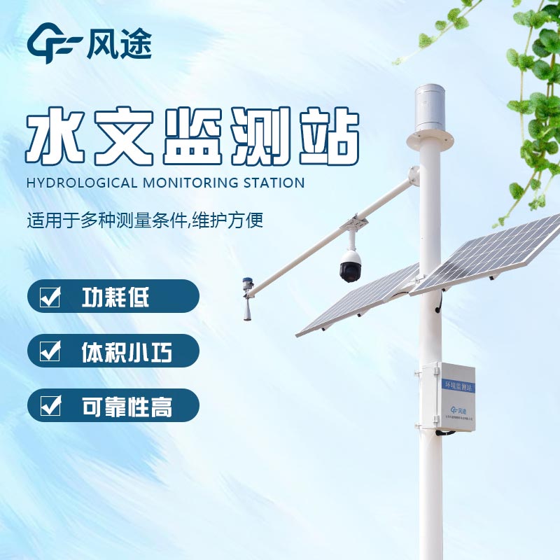
With the help of the Water Early Warning System, combined with big data analytics, we are able to track core parameters such as rainfall, water levels and flow rates in real time to predict the risk of flooding and its development trends. This will allow us to take precautionary measures in advance to reduce the likelihood of disasters. Smart water conservancy also provides the ability to respond quickly and coordinate scheduling to ensure that timely relief and recovery work can be carried out smoothly after a disaster.
The Water Conservancy Early Warning System installs equipment such as water level gauges, rain gauges and flow meters to monitor water levels, rainfall and flow rates of rivers, lakes and reservoirs in real time. The data are transmitted through sensors to a central monitoring centre for timely analysis of flood risks.
This paper addresses:https://fengtusz.com/industry/74.html