River level measurement is a professional device used for real-time continuous monitoring of water level changes in rivers, lakes, reservoirs, and other water bodies. It employs K-band planar radar technology for non-contact measurement and is typically equipped with a solar power system, enabling remote monitoring and management, providing data support for flood control, drought relief, and water resource management.
River level measurement is a specialized facility specifically designed for continuously monitoring water level changes in natural and artificial water bodies. This device uses advanced technology to accurately measure water levels and remotely transmits the data to a management center, providing crucial decision-making information for water conservancy project management, disaster prevention and mitigation, and water resource allocation.
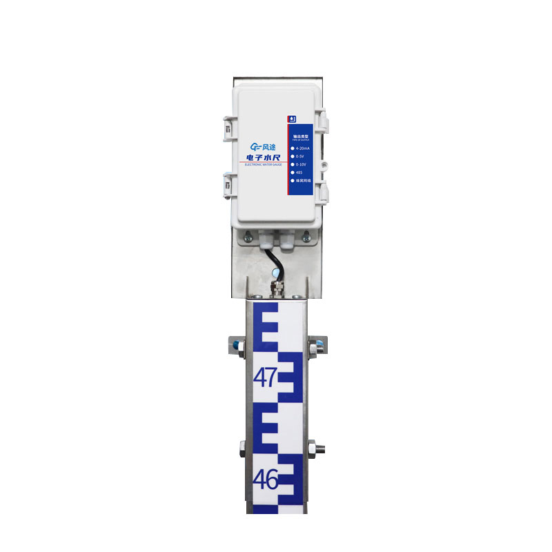
In terms of technical principles, modern River level measurement primarily utilizes K-band planar radar technology. This technology works by emitting electromagnetic wave signals of a specific frequency towards the water surface and receiving the reflected echoes. By calculating the time difference between transmission and reception, the distance between the sensor and the water surface is accurately determined, thus obtaining the actual water level. This non-contact measurement method avoids the problems of sensor damage from floating objects and sediment accumulation encountered in traditional contact measurements, resulting in higher reliability and stability. During the measurement process, the device automatically eliminates environmental interference, ensuring data accuracy.
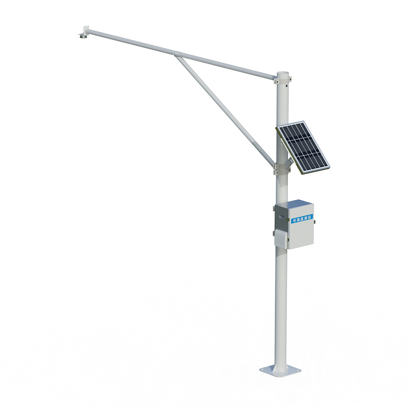
The system components of River level measurement include a measurement unit, a power supply system, a data acquisition and transmission module, and a support structure. The core of the measurement unit is the radar water level gauge, responsible for real-time water level detection. The power supply system typically uses solar photovoltaic panels combined with battery packs to ensure long-term stable operation even in remote areas without mains electricity. The data acquisition unit processes the measurement signals and converts them into standard water level data, which is then sent to the monitoring center wirelessly via GPRS, 4G, or satellite communication. The entire device is installed on a sturdy column or tower to ensure the sensor remains at the appropriate measurement height.
This monitoring station plays a vital role in river water level monitoring. By establishing a monitoring network along the river, water conservancy departments can real-time monitor water level changes throughout the entire basin. In reservoir management, water level data is a key parameter for regulating water storage and ensuring dam safety. For agricultural irrigation areas, water level monitoring helps in the rational allocation of irrigation water, improving water resource utilization efficiency. In lake water ecological research, long-term water level records provide basic data for studying lake evolution patterns.
The outstanding advantages of River level measurement lie in its automated operation and remote management capabilities. Once installation and commissioning are complete, the equipment can operate continuously for several months without manual intervention. Monitoring center personnel can view water level data from each monitoring point in real time using specialized software. The system automatically generates water level change curves and immediately issues an alarm when the water level exceeds a preset warning value. This timely early warning mechanism saves valuable time for flood control and emergency response, significantly enhancing disaster prevention and mitigation capabilities.
With the development of IoT technology, River level measurement is being integrated with other hydrological monitoring equipment to form a complete automated hydrological monitoring and reporting system. These systems provide more comprehensive information support for water resource management and flood control scheduling by comprehensively analyzing multi-element data such as water level, rainfall, and flow rate. In the construction of smart water management systems, River level measurement, as a basic sensing layer device, will become even more important, and its application scope will expand to more areas.
This paper addresses:https://fengtusz.com/industry/890.html