
Product Center
-
Hydrological equipment monitoring station
-
Water Quality Monitor Sensor
-
Plant protection equipment
-
Food Testing Equipment
- How does Multi Depth Soil Moisture Probe achieve simultaneous measurement of soil temperature and humidity at multiple depths?
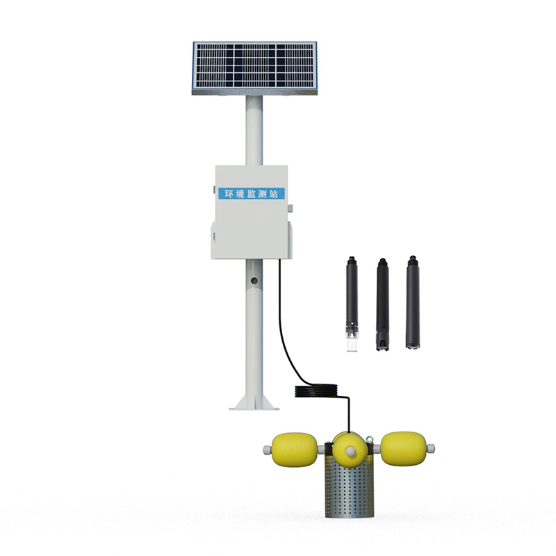
- The standard buoy five-parameter monitoring system enables automatic water quality data acquisition and remote transmission
- How the Tubular Soil Temperature and Moisture Monitor Achieves Simultaneous Multi-Layer Soil Parameter Measurement
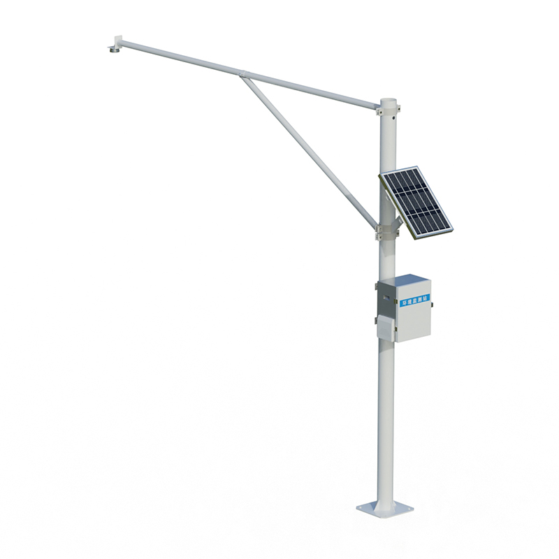
- IoT Water Quality Monitoring Station enables the automatic acquisition and remote transmission of in-situ water quality monitoring data
- Soil Moisture Monitoring Enables Simultaneous Measurement of Soil Temperature and Moisture at Multiple Depths
- The high-spec buoy with five parameters enables more accurate lake water quality monitoring
Shandong Fengtu IOT Technology Co., Ltd
Sales Manager:Ms. Emily Wang
Tel, Whatsapp:+86 15898932201
Email:info@fengtutec.com
Add:No. 155 Optoelectronic Industry Accelerator, Gaoxin District, Weifang, Shandong, China
-
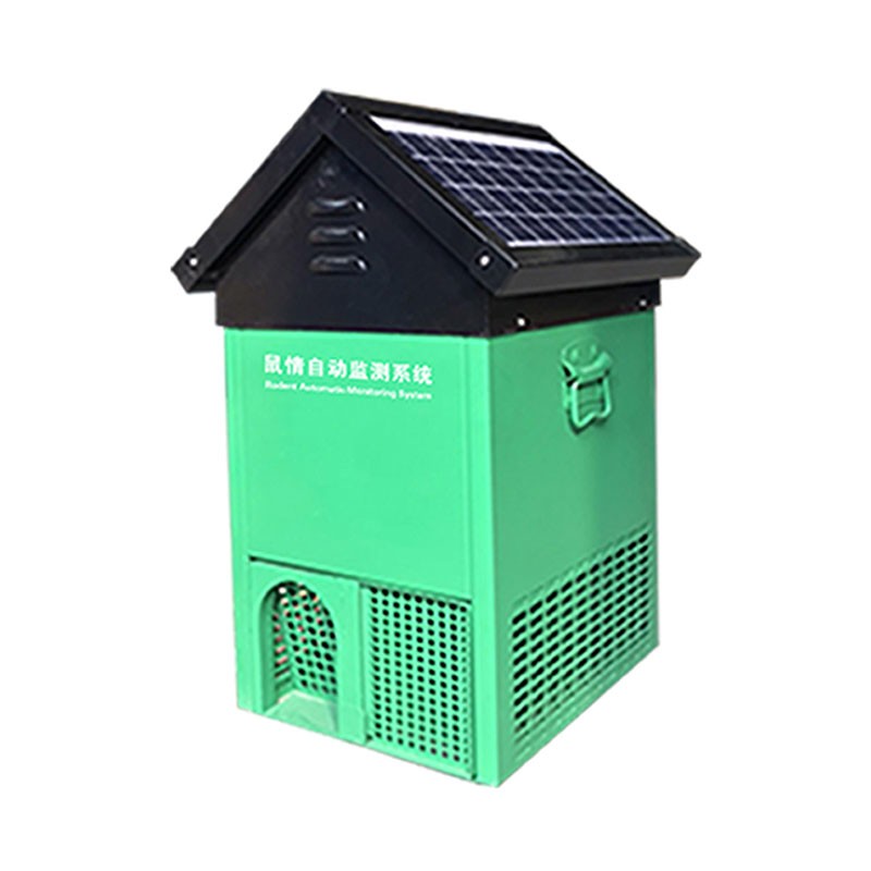
Rodent Monitoring Device: Automated Capture, Identification, and Reporting via One-Way Passage and HD Camera
The rodent monitoring device is an intelligent monitoring unit integrating infrared sensing, high-definition photography, and AI image recognition technologies. It features an internal one-way passage design that prevents rodents from escaping once they enter. Upon triggering, the device autom...
Learn more - 202607-13
-
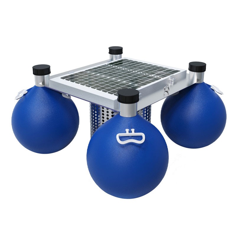
Floating island-type solar-powered water quality monitoring equipment can be deployed and installed without hoisting
This equipment integrates data acquisition, storage, transmission, and management, and consists of six parts: water quality sensors, a data acquisition instrument, a communication system, a power supply system, a support frame, and a monitoring platform. It can be deployed without hoisting and...
Learn more - 202607-10
-
Soil Moisture Monitoring Equipment Eliminates Experience-Based Irrigation Decisions
This soil moisture monitoring equipment is an online monitoring system based on the FDR (Frequency Domain Reflectometry) principle. It can measure soil profile temperature, humidity, and conductivity in real time with an accuracy of ±3%, covering a range of 0-100% humidity and 0-20000 μS/cm...
Learn more - 202607-06

-
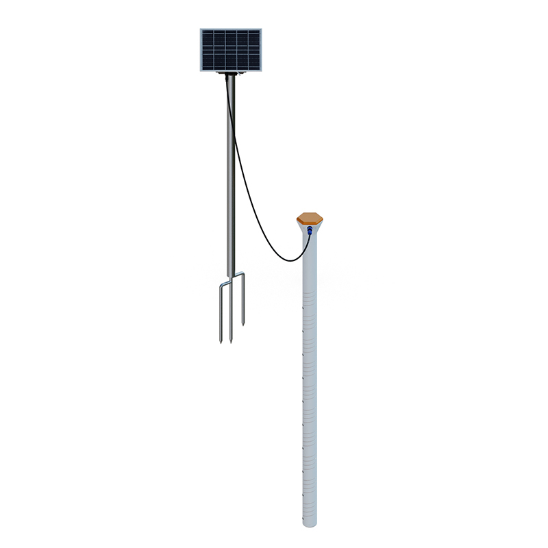
The water level detector utilizes K-band planar radar technology to achieve non-contact, high-precision water level measurement
This water level detector is a fully automated online hydrological monitoring system based on microwave technology. It employs K-band planar radar technology for non-contact water level measurement, with a ranging range of 0.1 to 40 meters and an accuracy of ±5 millimeters. It is suitable for...
Learn more - 202607-03
-
Moisture meter enables precise irrigation management through multi-layer soil monitoring
The moisture meter is an intelligent sensor used to monitor soil profile temperature, humidity, and conductivity. It uses the 485 Modbus RTU communication protocol and can measure 6 layers of soil data at the same time. Products are widely used in agricultural engineering fields such as smart...
Learn more - 202607-01
-
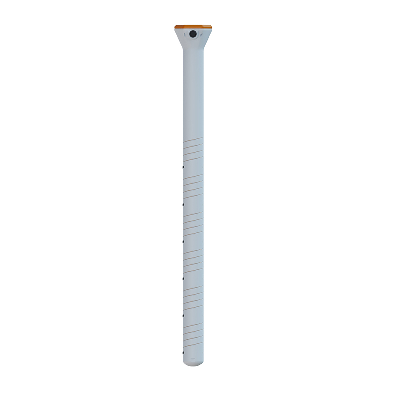
Radar water level monitoring stations utilize non-contact radar technology to achieve millimeter-level precise water level measurement
The radar water level monitoring station is a fully automated online hydrological monitoring system based on microwave radar technology. It uses K-band planar radar to measure water levels non-contactly, with a ranging range of 0.1 to 40 meters, an accuracy of ±5 mm, and a resolution of 1 mm....
Learn more - 202606-30

-
The Layered Monitoring Principle of Soil moisture monitor and its Application in Smart Agriculture
Soil moisture monitor is a soil monitoring sensor based on the dielectric constant principle. It can simultaneously measure three parameters: soil temperature, moisture, and conductivity. It supports layered observation points and uploads data to a cloud platform via GPRS or 4G networks. It is...
Learn more - 202606-29

-
The Road Flooding Monitoring System Utilizes Radar Technology for Non-Contact Water Level Early Warning of Urban Flooding
The Road Flooding Monitoring System is a fully automated online hydrological monitoring device based on K-band planar radar technology. It measures water levels non-contactly, unaffected by temperature, sediment, pollutants, and floating debris. The system features low power consumption, small...
Learn more - 202606-25
-
Multi Depth Soil Moisture Probe Simultaneously Measures Temperature, Humidity, and Conductivity of Ten Soil Layers
Multi Depth Soil Moisture Probe is developed based on the principle of dielectric constant and can simultaneously monitor the temperature, humidity, and conductivity of ten soil layers. The soil temperature measurement range is -30 to 70℃, humidity is 0 to 100%, and conductivity is 0 to 20000...
Learn more - 202606-24
-
What equipment is needed to scientifically monitor the aquaculture environment in fishponds?
Fishpond water quality monitoring equipment uses water quality sensors such as those for temperature, conductivity, pH, and dissolved oxygen as its core. It monitors and analyzes various water quality parameters in real time, transmitting the collected data to a platform for remote viewing and...
Learn more - 202606-23